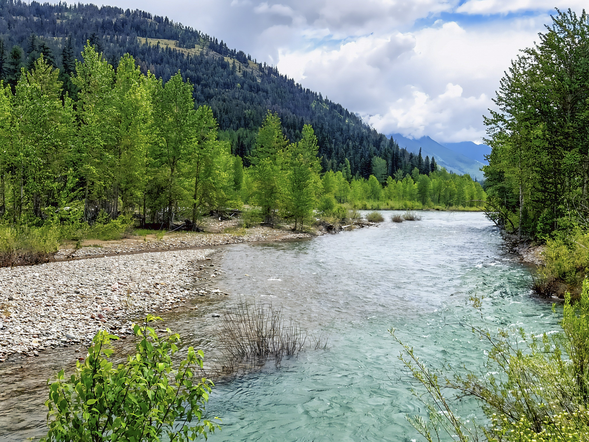

While traveling from East Glacier to West Glacier along U.S. Highway 2 in Montana, we stopped beside the Middle Fork Flathead River to enjoy the natural beauty of the Rocky Mountains. Located along the southern boundary of Glacier National Park, this river flows through one of the most remarkable mountain landscapes in the northwestern United States. The Middle Fork begins in the Great Bear Wilderness and eventually joins the North Fork Flathead River, becoming part of the larger Flathead River system. The river is known for its clear waters, mountain scenery, and opportunities for rafting, fishing, and wildlife watching. Travelers following U.S. Highway 2 can experience portions of this beautiful river corridor without venturing far from the main highway. The river is also part of the federally protected Flathead Wild and Scenic River system, recognized for its exceptional natural and recreational values (National Wild and Scenic Rivers System, n.d.).
The Middle Fork Flathead River has an important conservation history. The river and its surrounding wilderness helped inspire efforts to protect America’s remaining free-flowing rivers. Conservationists, including wildlife biologists John and Frank Craighead, advocated for river protection during a period when proposed dams threatened portions of the Flathead River system. These efforts contributed to the development of the National Wild and Scenic Rivers Act, which established a national framework for protecting rivers with outstanding ecological, geological, scenic, and recreational importance. The Middle Fork later received federal protection as part of the Flathead Wild and Scenic River designation. The surrounding landscape also holds deep cultural significance for Indigenous peoples, including the Ktunaxa, Séliš, Kootenai, and Pikuni, whose connections to the region extend across generations (Flathead Rivers Alliance, n.d.; National Wild and Scenic Rivers System, n.d.).

From a geological perspective, the Middle Fork Flathead River flows through a landscape shaped by ancient sedimentation, tectonic forces, glaciers, and continuing river erosion. Many of the rocks forming the mountains around Glacier National Park originated as sediments deposited in an ancient inland sea more than a billion years ago. Geological forces later uplifted and displaced these rock layers, while massive glaciers carved valleys and steep mountain slopes. Today, flowing water continues to reshape the landscape by transporting rocks, gravel, and fine sediments downstream. During periods of high runoff, rivers can erode their banks, redistribute sediment, and create gravel bars and new channels. The Middle Fork’s blue-green appearance is influenced by water clarity, light, and the characteristics of its riverbed, although its color can change with sediment levels and weather conditions. These processes demonstrate how the region’s geological history continues to influence its modern river systems (National Park Service, n.d.-a, n.d.-b).
The Middle Fork Flathead River also supports an ecologically important freshwater environment within the greater Crown of the Continent ecosystem. Its cold, flowing waters and tributaries provide habitat for native fish, including bull trout, while surrounding forests and riverside vegetation support numerous wildlife species. Riparian ecosystems—the areas where rivers meet the surrounding land—are especially important because they provide shade, stabilize riverbanks, contribute organic material to aquatic food webs, and create habitat for birds, mammals, and insects. The broader Flathead River corridor supports diverse plant communities and provides important habitat connections for wildlife, including grizzly bears and other wide-ranging species. Protecting the river’s natural flow, water quality, and surrounding vegetation helps preserve these ecological relationships. For travelers and science-lovers, a stop along the Middle Fork Flathead River offers more than a scenic break from the road; it provides an opportunity to appreciate the connections between geology, freshwater ecosystems, wildlife conservation, and the natural processes that continue shaping Montana’s mountain landscapes (National Wild and Scenic Rivers System, n.d.; U.S. Forest Service, n.d.).


References
Flathead Rivers Alliance. (n.d.). Flathead Wild & Scenic River quick facts. https://www.flatheadrivers.org/flathead-wild-and-scenic-river-quick-facts
National Park Service. (n.d.-a). Geologic activity. Glacier National Park. U.S. Department of the Interior. https://www.nps.gov/glac/learn/nature/geologicactivity.htm
National Park Service. (n.d.-b). Geologic formations. Glacier National Park. U.S. Department of the Interior. https://www.nps.gov/glac/learn/nature/geologicformations.htm
National Wild and Scenic Rivers System. (n.d.). Flathead River, Montana. https://www.fws.gov/rivers/river/flathead
U.S. Forest Service. (n.d.). Flathead National Forest land management plan. U.S. Department of Agriculture. https://www.fs.usda.gov/Internet/FSE_DOCUMENTS/fseprd603502.pdf
AI Disclosure Statement:
Artificial intelligence tools were used in the creation of this page, including elements such as writing, image enhancement/generation, voice enhancement, and/or editing support. All final creative decisions were made by the creator.

Leave a Reply