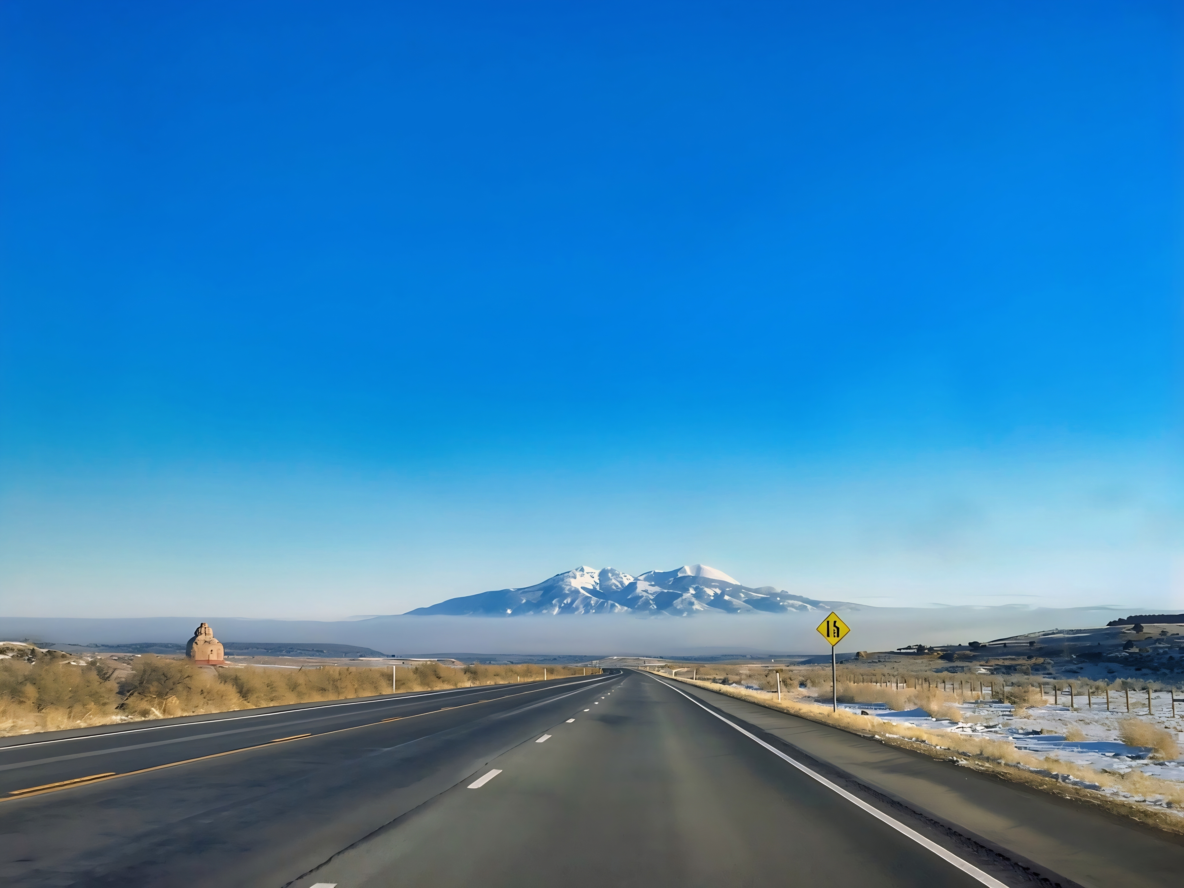

The La Sal Mountains rise above Dry Valley and the red-rock country of southeastern Utah, creating one of the most dramatic elevation contrasts on the Colorado Plateau. The range belongs to the Manti-La Sal National Forest and includes several summits higher than 12,000 feet, with Mount Peale reaching approximately 12,721 feet. Its Spanish name means “Salt Mountains,” reflecting the pale, snow-covered appearance that early Spanish travelers reportedly mistook for salt. From the surrounding desert, visitors can see rugged peaks, forested slopes and seasonal snowfields towering above broad valleys of sagebrush, grassland and pinyon-juniper woodland (Moab Office of Tourism, n.d.; U.S. Forest Service, n.d.).
U.S. Route 191 offers impressive views of the La Sal Mountains while connecting Monticello, Moab and other destinations in southeastern Utah. Near Church Rock, State Route 211 branches west toward Newspaper Rock and the Needles District of Canyonlands National Park. Travelers who want a closer mountain experience can explore the La Sal Mountain Loop Road near Moab, a scenic drive that climbs from desert terrain into oak brush, aspen groves, conifer forests and high mountain meadows. Conditions can change rapidly with elevation, and snow, thunderstorms, wildfire activity or rough seasonal roads may affect access, so visitors should consult current Forest Service information, carry sufficient water and avoid parking along active highway lanes (Moab Office of Tourism, n.d.; U.S. Forest Service, n.d.).

Church Rock is a prominent sandstone formation near the junction of U.S. 191 and State Route 211, standing apart from the distant igneous peaks of the La Sal Mountains. Its rounded and layered shape was created as wind, water and temperature changes gradually removed weaker surrounding sedimentary rock. Local stories have connected the formation with Marie Ogden’s nearby Home of Truth, a short-lived religious settlement established in Dry Valley, but the opening cut into Church Rock was reportedly made for storing livestock feed and salt rather than creating a church. The La Sal Mountains have a very different origin: magma pushed between older sedimentary layers and formed intrusive bodies, including laccoliths, roughly 25–28 million years ago. Later erosion stripped away much of the softer rock above them, revealing the resistant igneous mountain cores seen today (Friedman & Huffman, 1998).
The La Sal Mountains function as a high-elevation ecological island surrounded by arid canyon country. Vegetation changes with altitude from pinyon pine, Utah juniper and shrubland to ponderosa pine, Douglas-fir, aspen, spruce-fir forest, subalpine meadow and fragile alpine tundra. Wildlife may include mule deer, elk, black bears, mountain lions, wild turkeys, golden eagles and smaller alpine animals; introduced mountain goats also inhabit portions of the high country. Recent research using satellite radar documented continuing movement in several La Sal Mountain rock glaciers—masses of ice-rich debris that slowly creep downslope and may store water within the alpine landscape. The Forest Service is also monitoring high-elevation vegetation, trail-camera observations and the locally distinctive La Sal daisy to understand how recreation, animals and changing environmental conditions are affecting this isolated alpine ecosystem (Munroe & Handwerger, 2024; U.S. Forest Service, n.d.).

References:
- Friedman, J. D., & Huffman, A. C., Jr. (Eds.). (1998). Laccolith complexes of southeastern Utah: Time of emplacement and tectonic setting. U.S. Geological Survey.
- Moab Office of Tourism. (n.d.). La Sal Mountains and scenic travel information.
- Munroe, J. S., & Handwerger, A. L. (2024). Contemporary movement of rock glaciers in the La Sal and Uinta Mountains, Utah, USA. Quaternary Science Advances, 14, 100188.
- U.S. Forest Service. (n.d.). Manti-La Sal National Forest.
- U.S. Forest Service. (n.d.). Plants and alpine-ecosystem monitoring.
AI Disclosure Statement:
Artificial intelligence tools were used in the creation of this page, including elements such as writing, image enhancement, voice enhancement, and/or editing support. All final creative decisions were made by the creator.

Leave a Reply