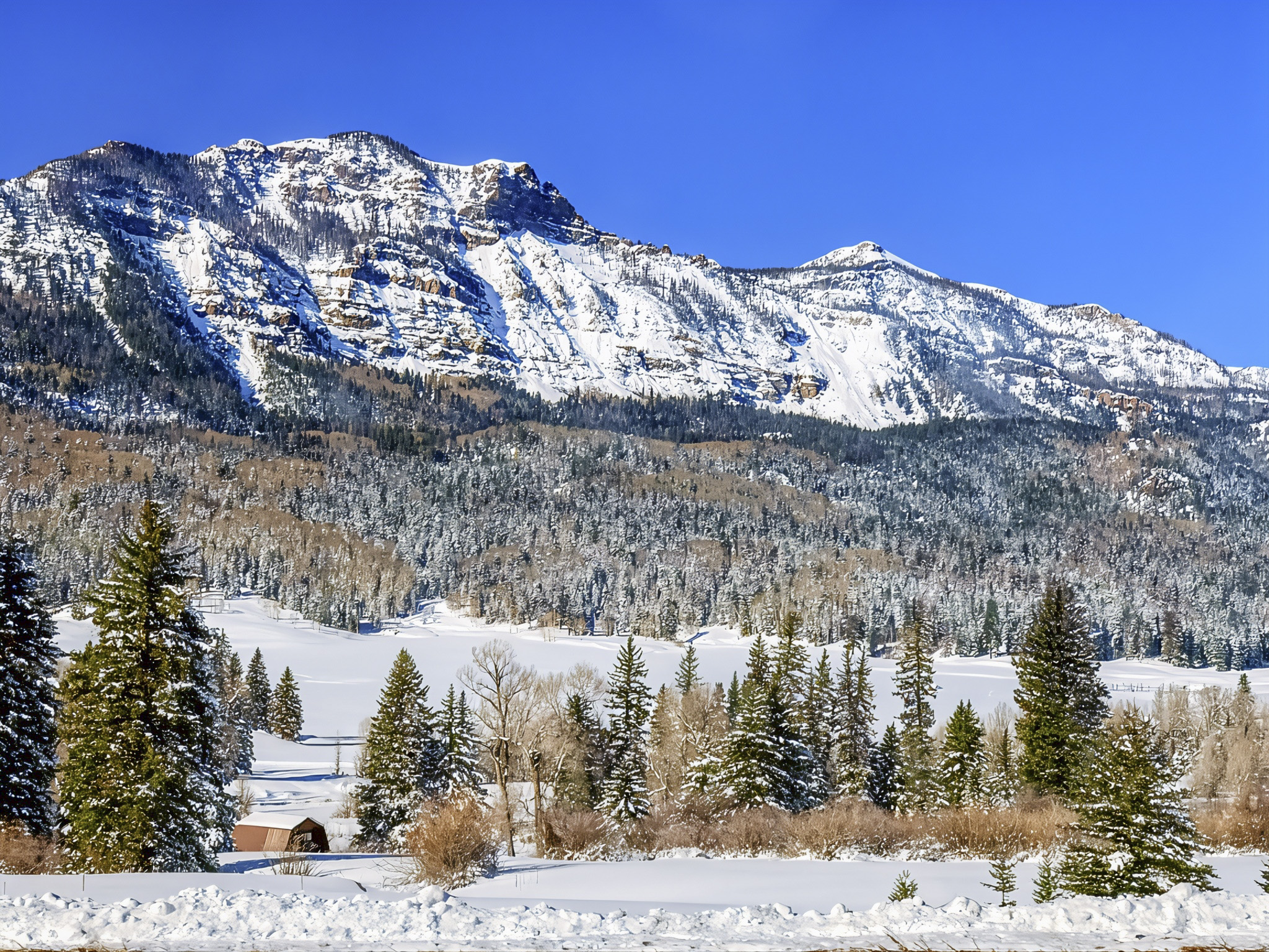

The drive from Pagosa Springs to Monte Vista along US-160 is one of southern Colorado’s most dramatic transitions, beginning in the broad valleys near Pagosa Springs, climbing deep into the San Juan Mountains, crossing the Continental Divide at Wolf Creek Pass, and eventually descending toward South Fork and the wide-open San Luis Valley. The mountain portion demands more attention than an ordinary highway drive: steep grades, sharp curves, rapidly changing weather, and winter snow can make conditions challenging. On the west side of Wolf Creek Pass, the highway includes a roughly 7-percent grade and several significant curves, so travelers should check road conditions and allow extra margin for changing mountain weather (Colorado Department of Transportation [CDOT], n.d.). Scenic stops include the Wolf Creek Pass overlook and the summit area, where travelers can also access the Continental Divide National Scenic Trail (U.S. Forest Service, 2025).
For geology lovers, this drive is almost like traveling through a natural textbook. The San Juan Mountains preserve the remains of an enormous volcanic province that developed when large volcanoes, calderas, lava flows, and explosive eruptions reshaped southwestern Colorado millions of years ago. U.S. Geological Survey research describes the southern Rocky Mountain volcanic field as a landscape that evolved from large andesitic volcanoes to major caldera systems that produced enormous sheets of volcanic ash and rock (U.S. Geological Survey [USGS], 2022). As US-160 crosses Wolf Creek Pass and begins descending eastward, travelers move from this rugged volcanic high country toward a very different landform—the San Luis Valley, which occupies one of the largest structural basins of the Rio Grande Rift. The valley developed as Earth’s crust stretched and faulted, allowing sections of crust to drop relative to the surrounding mountains and creating the broad basin visible around Del Norte and Monte Vista (USGS, 2021).

The biological scenery changes just as noticeably with elevation. Around Wolf Creek Pass and the Rio Grande National Forest, cold, snowy subalpine forests include Engelmann spruce, subalpine fir, aspen, and other high-elevation vegetation. These forests provide important habitat for animals such as elk, mule deer, moose, American marten, and the federally threatened Canada lynx. Forest Service research has identified the high-elevation spruce-fir forests of the Rio Grande National Forest as particularly important lynx habitat, while also documenting extensive ecological changes caused by spruce beetle outbreaks (U.S. Forest Service, 2021). Travelers therefore pass through an ecosystem where deep snow, forest structure, elevation, insects, and wildlife are tightly connected. During warmer seasons, roadside meadows and openings can also reveal wildflowers and wildlife, while winter transforms the same landscape into a deep-snow subalpine environment.
After descending toward South Fork, the scenery opens dramatically as US-160 follows the Rio Grande corridor through Del Norte and toward Monte Vista. Mountain walls gradually give way to ranches, agricultural fields, wetlands, distant peaks, and the immense sky of the San Luis Valley. Snowmelt from the surrounding mountains feeds the Rio Grande, groundwater, wet meadows, playas, willow communities, and cottonwood corridors, creating productive wildlife habitat within an otherwise relatively dry high-elevation basin (U.S. Fish & Wildlife Service [USFWS], n.d.). Near Monte Vista, travelers interested in biology can make a worthwhile side trip to Monte Vista National Wildlife Refuge, where wetlands and agricultural fields provide important habitat for waterfowl and migrating sandhill cranes. Thousands of cranes use the San Luis Valley as a seasonal stopover, making this portion of the journey especially rewarding for birdwatchers and nature photographers (USFWS, n.d.; Colorado Parks and Wildlife, n.d.).


References:
Colorado Department of Transportation. (n.d.). Traveling US 160 Wolf Creek Pass: Beware the Wolf. Colorado Department of Transportation – Wolf Creek Pass
U.S. Forest Service. (2025). Continental Divide Trail recreation: Wolf Creek Trailhead. U.S. Forest Service – Wolf Creek Trailhead
U.S. Forest Service, Rocky Mountain Research Station. (2021). Forest understories became the story: Lynx, bark beetle mortality, and salvage logging. U.S. Forest Service Research – Lynx and Spruce Forests
U.S. Geological Survey. (2022). Field-trip guide to continental arc to rift volcanism of the southern Rocky Mountains. USGS – Southern Rocky Mountain Volcanism
U.S. Geological Survey. (2021). Surficial geology of the northern San Luis Valley. USGS – San Luis Valley Geology
U.S. Fish & Wildlife Service. (n.d.). Monte Vista National Wildlife Refuge. USFWS – Monte Vista National Wildlife Refuge
Colorado Parks and Wildlife. (n.d.). Sandhill crane. Colorado Parks and Wildlife – Sandhill Crane
AI Disclosure Statement:
Artificial intelligence tools were used in the creation of this page, including elements such as writing, image enhancement/generation, voice enhancement, and/or editing support. All final creative decisions were made by the creator.


Leave a Reply