

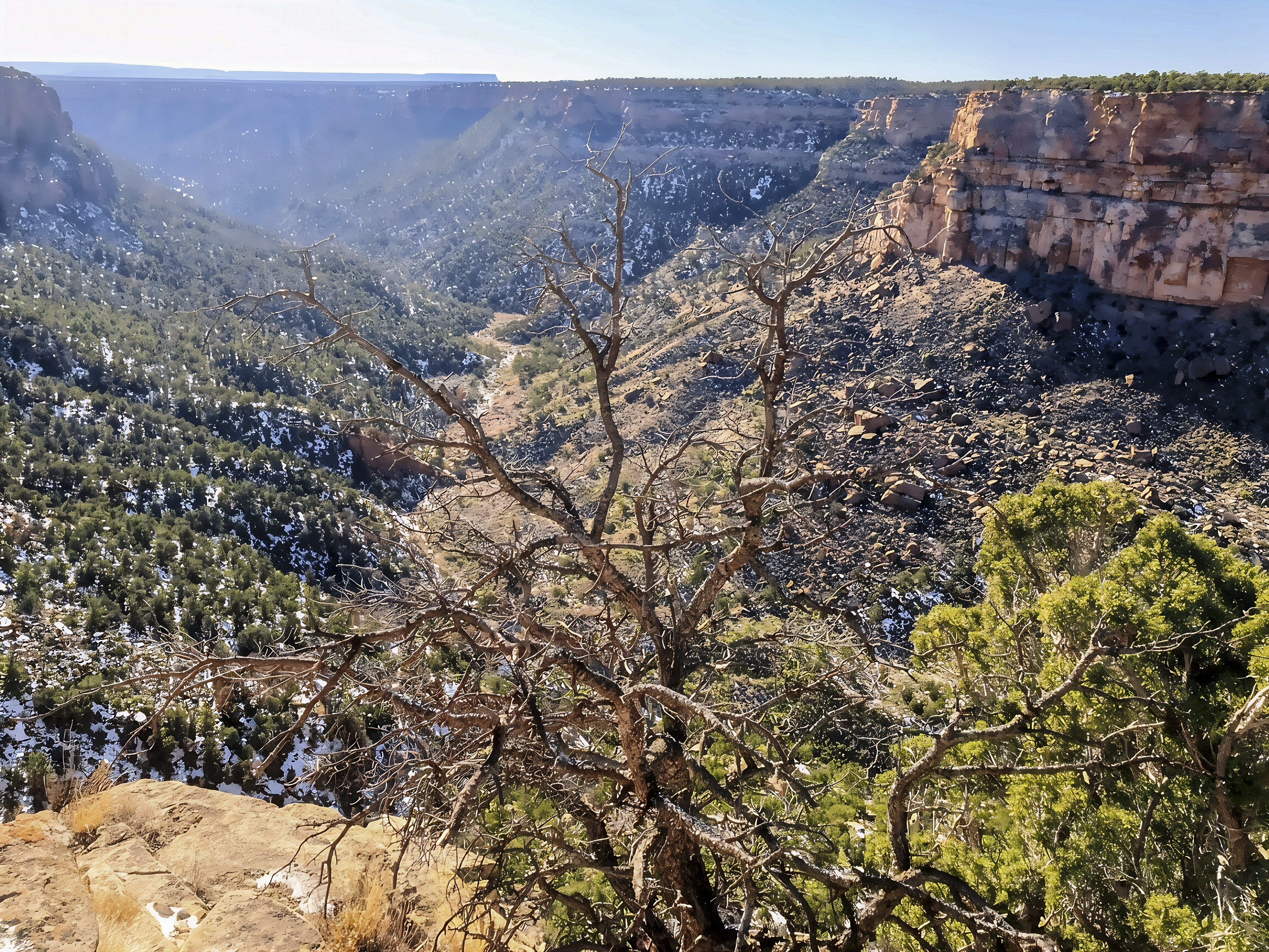
The La Plata Mountains form a compact, rugged mountain group on the southwestern margin of Colorado’s San Juan Mountains, rising dramatically above the lower country near Mancos and Durango. From viewpoints along the northern edge of Mesa Verde National Park—like the location of your photo—the snow-covered La Platas dominate the northeastern horizon beyond the broad Mancos Valley. Their highest ridges form a roughly horseshoe-shaped arc around the upper La Plata River basin, with Hesperus Mountain forming the high point of the range. Other prominent summits include Lavender Peak, Mount Moss, Babcock Peak, Spiller Peak, Centennial Peak, and Diorite Peak, several of which rise above 13,000 feet. The mountains also form important headwaters for the La Plata River and the East, Middle, and West Mancos rivers (Lundstrom et al., 2026).
For travelers, one of the easiest ways to appreciate the range is from Mesa Verde National Park, where Mancos Overlook, Point Lookout, and Park Point provide broad views toward the mountains and the valley below. Mancos Overlook looks directly across the Mancos Valley, where ranchland, agricultural fields, the Mancos River, woodland, and eroded gray hills create a striking foreground beneath the snowy summits (National Park Service [NPS], 2026). Closer exploration is possible in the San Juan National Forest, especially through La Plata Canyon, where visitors can hike, camp, fish, photograph waterfalls and historic mining landscapes, and reach high-country trails around Kennebec Pass. Upper mountain roads can become rough, steep, snow-covered, or suitable only for high-clearance four-wheel-drive vehicles, so road and weather conditions should be checked before traveling into the high country (U.S. Forest Service [USFS], n.d.).

Geologically, the La Plata Mountains are especially interesting because they mark a transition between the Colorado Plateau and the San Juan Mountains. Rather than being the remains of a single giant surface volcano, the range developed largely from magma that intruded underground during the Laramide mountain-building episode. Intrusive stocks, sheets, sills, and dikes pushed up and deformed older sedimentary layers into the La Plata dome roughly 75–60 million years ago, and later erosion exposed the resistant igneous rocks that help form today’s rugged peaks (Colorado Geological Survey [CGS], 2000; Lundstrom et al., 2026). During the Late Pleistocene, glaciers occupied several of the higher valleys and helped sculpt basins and mountain slopes. Down in the Mancos Valley and around Mesa Verde, the landscape changes dramatically to Cretaceous sedimentary rocks, including the gray Mancos Shale, deposited when the Western Interior Seaway covered this region millions of years ago (NPS, n.d.).
Biologically, the strong elevation gradient creates a sequence of habitats from lower sagebrush, Gambel oak, ponderosa pine, and mixed-conifer woodland to aspen, spruce-fir forest, high mountain meadows, and alpine environments near the summits. These habitats support wildlife such as elk, mule deer, black bear, mountain lion, grouse, raptors, and numerous smaller mammals and birds, while seasonal snowmelt feeds streams and riparian habitats below (USFS, 2013). One of the most important recent scientific developments is a new Colorado Geological Survey digital geologic map of most of the La Plata Mountains, published in 2026 using modern LiDAR, field mapping, geochemistry, and several radiometric dating techniques to refine understanding of the intrusive complex, glacial deposits, and mineralized rocks (Lundstrom et al., 2026). Recent regional ecological research has also examined how elk, mule deer, and pronghorn use terrain, vegetation, and seasonal green-up while migrating through the southern San Juan landscape (Ennis et al., 2026). Meanwhile, snow research remains especially important: monitoring in the San Juan Mountains showed unusually early snowmelt and reduced runoff during 2026, emphasizing how closely mountain ecosystems, streams, wildlife habitat, and downstream communities depend on the timing and persistence of winter snowpack (Natural Resources Conservation Service [NRCS], 2026).

References:
- Colorado Geological Survey. (2000). Geologic map of the Hesperus quadrangle, La Plata and Montezuma Counties, Colorado. Colorado Geological Survey – Hesperus geologic map
- Ennis, J. R., Tatman, N. M., Sesnie, S. E., & Cain, J. W., III. (2026). Habitat characteristics along spring migration routes of elk, mule deer, and pronghorn in the southern San Juan Mountains. The Journal of Wildlife Management, 90(7), e70248. Journal of Wildlife Management article
- Lundstrom, S., Gonzales, D., Longridge, J., & O’Keeffe, M. K. (2026). Digital geologic map database of the La Plata Mountains map area. Colorado Geological Survey. Colorado Geological Survey – La Plata Mountains map
- National Park Service. (2026). Park viewpoints: Mesa Verde National Park. NPS Mesa Verde viewpoints
- National Park Service. (n.d.). The geology of Mesa Verde. NPS geology of Mesa Verde
- Natural Resources Conservation Service. (2026). An early start to runoff and reduced seasonal volume. USDA NRCS snowpack report
- U.S. Forest Service. (n.d.). San Juan National Forest recreation. San Juan National Forest recreation information
AI Disclosure Statement:
Artificial intelligence tools were used in the creation of this page, including elements such as writing, image enhancement, voice enhancement, and/or editing support. All final creative decisions were made by the creator.

Leave a Reply