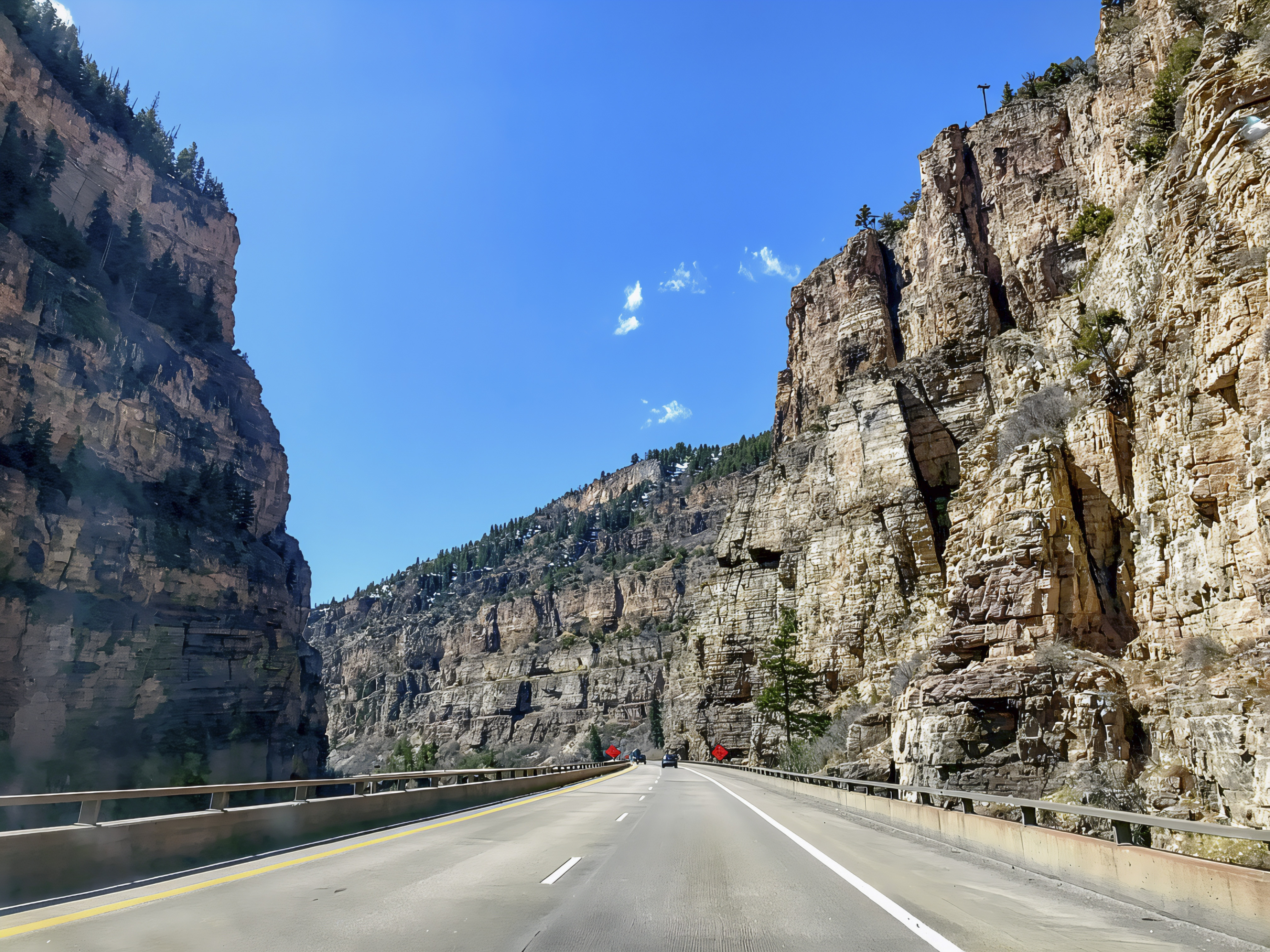

Driving west along Interstate 70 from Silverthorne to Glenwood Springs, Colorado, offers one of the most scenic mountain road trips in the American West. The route passes through the heart of the Rocky Mountains, combining towering peaks, alpine forests, picturesque valleys, and impressive highway engineering. Leaving Silverthorne, travelers follow I-70 toward Frisco and Copper Mountain before climbing toward Vail Pass, which reaches approximately 10,666 feet (3,251 meters) above sea level. This high-elevation section offers sweeping mountain views, evergreen forests, and dramatic changes in scenery as the highway winds through the rugged terrain. After crossing the pass, the road descends toward Vail, where ski resorts, mountain communities, and recreational trails create opportunities for sightseeing and outdoor activities. Although the interstate is maintained throughout the year, drivers should expect steep grades, changing weather, heavy recreational traffic, and potentially icy conditions during colder months (Colorado Department of Transportation [CDOT], 2012).
Continuing west from Vail, I-70 follows the Eagle River Valley, passing through the communities of Avon, Edwards, Eagle, and Gypsum. This portion of the journey offers a different mountain experience, with broad valleys, grassy hillsides, forested slopes, and rocky ridges surrounding the winding river. Travelers can explore Vail’s mountain village, visit nearby hiking trails, or stop in Eagle for outdoor recreation and a closer look at the region’s natural environment. Farther west, the landscape gradually becomes lower, warmer, and drier, with vegetation changing from dense conifer forests to more open woodlands, shrub-covered slopes, and riverside vegetation. Near Dotsero, the Eagle River joins the Colorado River, marking an important geographical transition before the highway enters Glenwood Canyon. The surrounding White River National Forest provides recreational opportunities including hiking, fishing, camping, and wildlife viewing, making the corridor attractive to both casual travelers and outdoor enthusiasts (U.S. Forest Service, n.d.).

One of the most spectacular parts of the drive begins when I-70 enters Glenwood Canyon, where the Colorado River flows between enormous cliffs and steep rocky slopes. This approximately 12.5-mile stretch is particularly impressive because the highway uses elevated roadways, bridges, and tunnels to navigate the narrow canyon while reducing its footprint on the surrounding landscape. For geology enthusiasts, the canyon reveals an extraordinary record of Earth’s past, including ancient sedimentary formations and much older crystalline rocks exposed by erosion. The U.S. Geological Survey identifies the Mississippian Leadville Limestone among the significant formations in the Glenwood Springs region, where carbonate rocks also play an important role in groundwater movement and the area’s famous hot springs (Geldon, 1989). Travelers can stop at designated rest areas such as Bair Ranch, Grizzly Creek, and No Name to enjoy views of the Colorado River, explore nearby trails, or observe the canyon’s remarkable geological formations. Another popular attraction is Hanging Lake, a protected natural landmark known for its clear turquoise water and mineral deposits, although visiting requires advance hiking permits and proper planning (Visit Glenwood Springs, n.d.-a, n.d.-b).
Beyond its geological beauty, the Silverthorne-to-Glenwood Springs corridor provides an opportunity to observe the ecological diversity of Colorado’s mountains. Higher elevations support lodgepole pine, Engelmann spruce, subalpine fir, and alpine vegetation, while lower valleys contain aspen groves, grasslands, shrubs, and cottonwood-lined waterways. These changing habitats support wildlife such as elk, mule deer, bighorn sheep, black bears, marmots, and numerous bird species, although sightings depend on season and location. Glenwood Canyon is especially interesting because its steep cliffs, river environment, and surrounding forests create different habitats within a relatively small area (U.S. Forest Service, n.d.; Visit Glenwood Springs, n.d.-a). The canyon also illustrates how natural disturbances influence mountain ecosystems. Wildfires can remove protective vegetation, increasing the risk of erosion, flooding, and debris flows during heavy rainfall, which may temporarily affect highway access (CDOT, 2021). As the journey concludes in Glenwood Springs, travelers can explore geothermal hot springs, nearby hiking destinations, and the Roaring Fork Valley. From high mountain passes to ancient canyon walls and diverse wildlife habitats, this stretch of I-70 offers an unforgettable combination of scenic driving, geology, ecology, and outdoor adventure.


References
Colorado Department of Transportation. (2012). CDOT ready to keep mountain passes open. https://www.codot.gov/news/2012-news-releases/12-2012/cdot-ready-to-keep-mountain-passes-open
Colorado Department of Transportation. (2021). Ongoing closure of I-70 through Glenwood Canyon due to rapid shifts in the weather forecast. https://www.codot.gov/news/2021/august-2021/glenwood-canyon-closure-update
Geldon, A. L. (1989). Hydrogeology of the Leadville limestone and other Paleozoic rocks in northwestern Colorado, with results of aquifer tests at Glenwood Springs. U.S. Geological Survey. https://doi.org/10.3133/wri874195
U.S. Forest Service. (n.d.). Glenwood Springs area—White River National Forest. https://www.fs.usda.gov/r02/whiteriver/recreation/glenwood-springs-area
Visit Glenwood Springs. (n.d.-a). Glenwood Canyon information. https://visitglenwood.com/things-to-do/glenwood-canyon/
Visit Glenwood Springs. (n.d.-b). Hanging Lake trail permits and information. https://visitglenwood.com/hanginglake
Visit Glenwood Springs. (n.d.-c). Glenwood Canyon Recreation Path. https://visitglenwood.com/things-to-do/glenwood-canyon-path
AI Disclosure Statement:
Artificial intelligence tools were used in the creation of this page, including elements such as writing, image enhancement/generation, voice enhancement, and/or editing support. All final creative decisions were made by the creator.


Leave a Reply