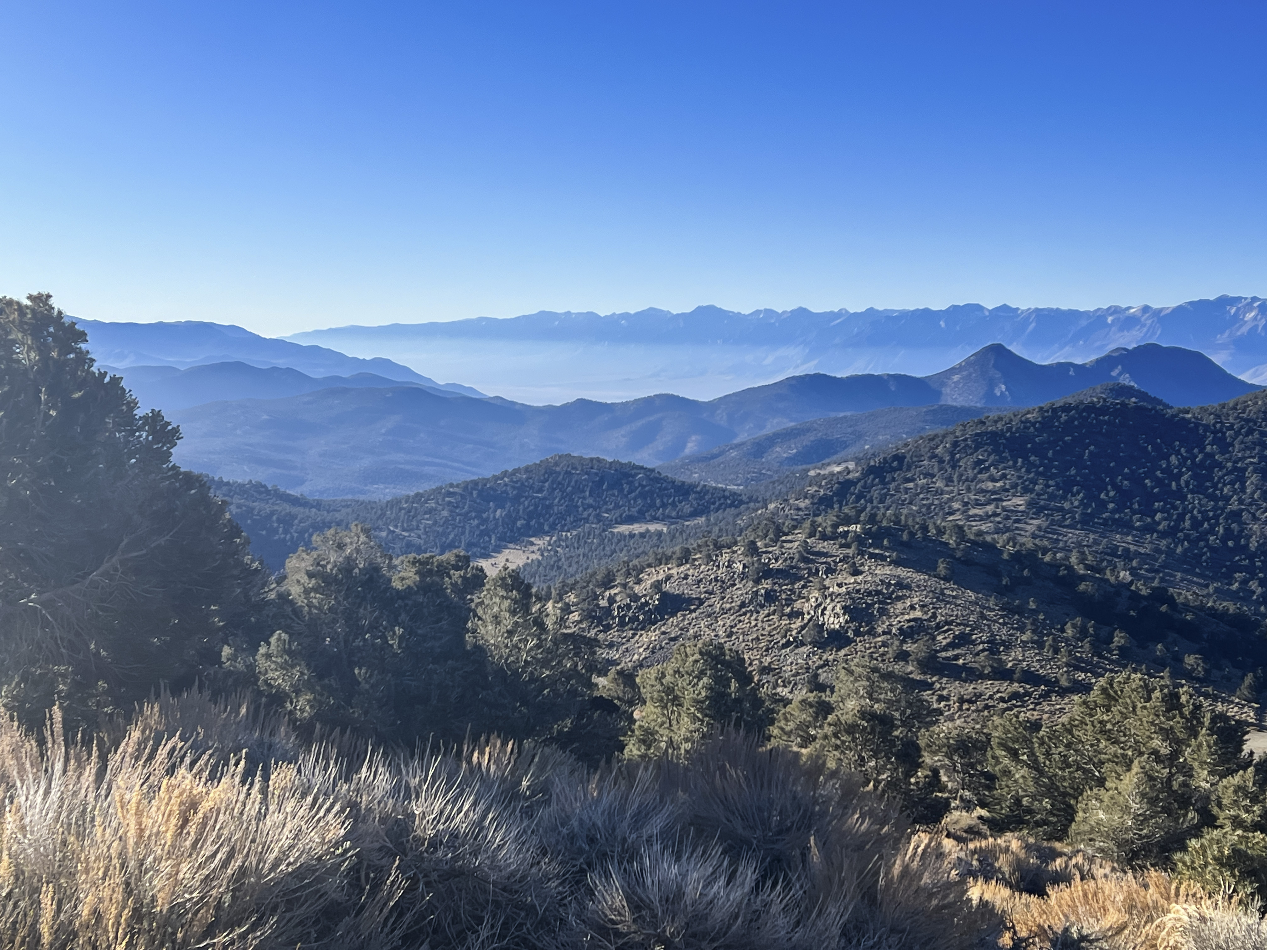

From this high-elevation viewpoint in California’s White Mountains, visitors can enjoy a sweeping panorama across Owens Valley toward the rugged Sierra Nevada. On exceptionally clear days, the view may extend from Mount Whitney to Mount Dana and even include a distant glimpse of Mono Lake (U.S. Forest Service [USFS], 2025). Travelers can reach the area from Big Pine by following Highway 168 and then turning onto White Mountain Road. Parking and interpretive panels are available, but there is no drinking water, so visitors should bring sufficient supplies and check road conditions before traveling, especially during snowy weather (USFS, 2025, 2026).
The scenery also reveals the powerful geological forces that shaped eastern California. Owens Valley lies between the Sierra Nevada to the west and the White Mountains to the east, with major fault zones extending along both sides. Movement along these faults over millions of years helped raise the surrounding mountains and lower the basin between them, creating the region’s dramatic changes in elevation (Beanland & Clark, 1994). The rocky slopes and scattered high-desert trees also show how plants survive intense sunlight, strong winds, cold winters, and limited moisture.


References:
Beanland, S., & Clark, M. M. (1994). The Owens Valley fault zone, eastern California, and surface faulting associated with the 1872 earthquake. U.S. Geological Survey. https://pubs.usgs.gov/bul/1982/report.pdf
U.S. Forest Service. (2025). Sierra View Observation Site. https://www.fs.usda.gov/r05/inyo/recreation/sierra-view-observation-site
U.S. Forest Service. (2026). Current conditions: Inyo National Forest. https://www.fs.usda.gov/r05/inyo/conditions
AI Disclosure Statement:
Artificial intelligence tools were used in the creation of this page, including elements such as writing, image enhancement/generation, voice enhancement, and/or editing support. All final creative decisions were made by the creator.



Leave a Reply