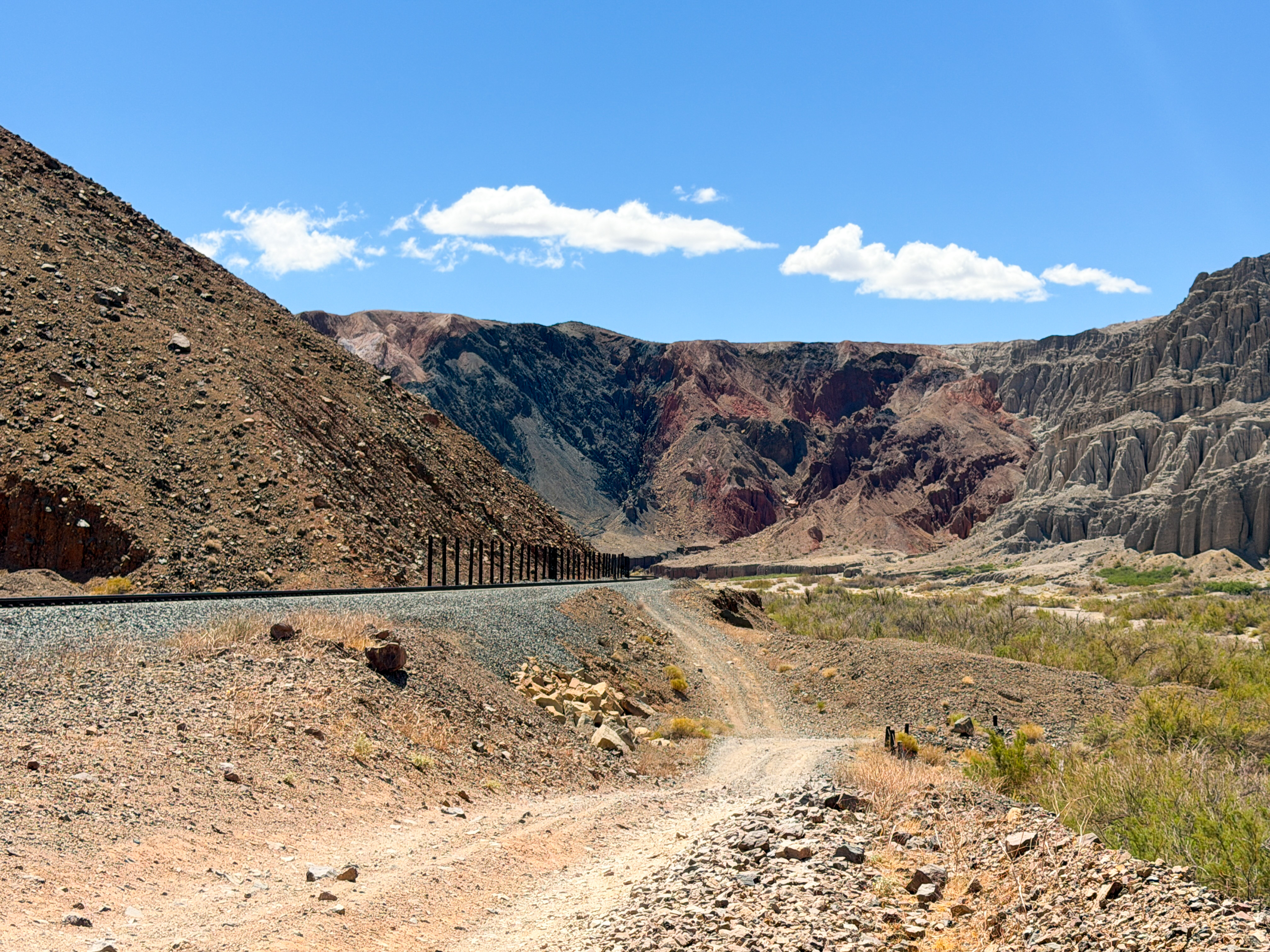

Afton Canyon Natural Area, sometimes called the “Grand Canyon of the East Mojave,” is a federally managed Area of Critical Environmental Concern within Mojave Trails National Monument, about 37 miles east of Barstow. The protected area covers approximately 41,500 acres, including about 23,600 acres of public land managed by the Bureau of Land Management. It is especially unusual because it is one of the few places where the normally underground Mojave River flows above ground throughout the year, creating a ribbon of water and vegetation across an otherwise arid landscape. Visitors can enjoy hiking, camping, birdwatching, photography, rockhounding, stargazing, horseback riding, and four-wheel-drive touring along designated routes (Bureau of Land Management [BLM], n.d.).
The main campground is reached from Interstate 15 at the Afton Road exit, followed by approximately three miles on a graded dirt road. Its 22 primitive, first-come campsites include shade structures, tables, fire rings, grills, and access to vault toilets, but visitors should bring all necessary drinking water because the campground’s water supply is not always available. Beyond the campground, travelers may encounter sandy tracks, deep ruts, railroad underpasses, flowing-water crossings, and sections unsuitable for ordinary passenger cars; road conditions can change dramatically after storms. Expect colorful canyon walls, riverbank vegetation, desert mountains, historic railroad features, and broad night skies, but also extreme heat, strong winds, flash floods, rattlesnakes, weak cellular service, and long distances from food, fuel, and emergency assistance (BLM, n.d.).

Afton Canyon records a complex geological history involving tectonic movement, changing climates, ancient lakes, river erosion, and catastrophic flooding. During the Pleistocene, the Mojave River emptied into Lake Manix, whose water and sediments occupied several basins around the present canyon. Lake deposits exposed in the canyon’s badlands preserve repeated cycles of rising water, drying, windblown sediment, and alluvial-fan formation; a major overflow eventually reorganized the drainage and helped carve the modern canyon. The nearby Manix Fault is part of the tectonically active Eastern California Shear Zone, where continuing USGS mapping uses field studies, remote sensing, geochronology, and high-resolution topographic data to examine fault behavior, groundwater basins, and landscape evolution (Reheis et al., 2014; U.S. Geological Survey [USGS], n.d.).
Biologically, the perennial river supports Fremont cottonwoods, Gooding’s black willows, mesquite, wet meadows, and other riparian plants that provide habitat for migratory birds, raptors, desert bighorn sheep, coyotes, bobcats, rabbits, reptiles, and numerous insects. Restoration work removed extensive stands of invasive tamarisk and planted more than 10,000 native cottonwood and willow poles, helping native vegetation and wildlife recover; more than 180 bird species have been reported in the canyon (Rempel, 2019). Recent regional research includes a USGS groundwater-quality assessment published in 2024 that examined the Mojave River aquifer system and the natural and human factors influencing water quality—important work because river infiltration helps recharge the floodplain aquifer connected with Afton Canyon (Groover et al., 2024). A recent newsworthy event also highlighted the remoteness of this corridor: a battery fire near Afton Canyon Road closed Interstate 15 for roughly two days in July 2024, produced extreme-heat gridlock and secondary emergencies, and was later cited by San Bernardino County fire officials as evidence of the area’s limited emergency-response capacity (San Bernardino County Fire Protection District, 2025).


References:
Bureau of Land Management. (n.d.). Afton Canyon—California. U.S. Department of the Interior.
Groover, K. D., Fram, M. S., & Levy, Z. F. (2024). Status and understanding of groundwater quality in the Mojave Basin Domestic-Supply Aquifer study unit, 2018—California GAMA Priority Basin Project. U.S. Geological Survey.
Reheis, M. C., Redwine, J. R., Wan, E., McGeehin, J. P., & VanSistine, D. P. (2014). Surficial geology and stratigraphy of Pleistocene Lake Manix, San Bernardino County, California. U.S. Geological Survey.
Rempel, A. (2019). Restoring an oasis in California’s Mojave Desert. American Forests.
San Bernardino County Fire Protection District. (2025). Comments concerning the Soda Mountain Solar Project. California Energy Commission.
U.S. Geological Survey. (n.d.). Western Basin and Range–Eastern California Shear Zone.
AI Disclosure Statement:
Artificial intelligence tools were used in the creation of this page, including elements such as writing, image enhancement, voice enhancement, and/or editing support. All final creative decisions were made by the creator.

Leave a Reply