

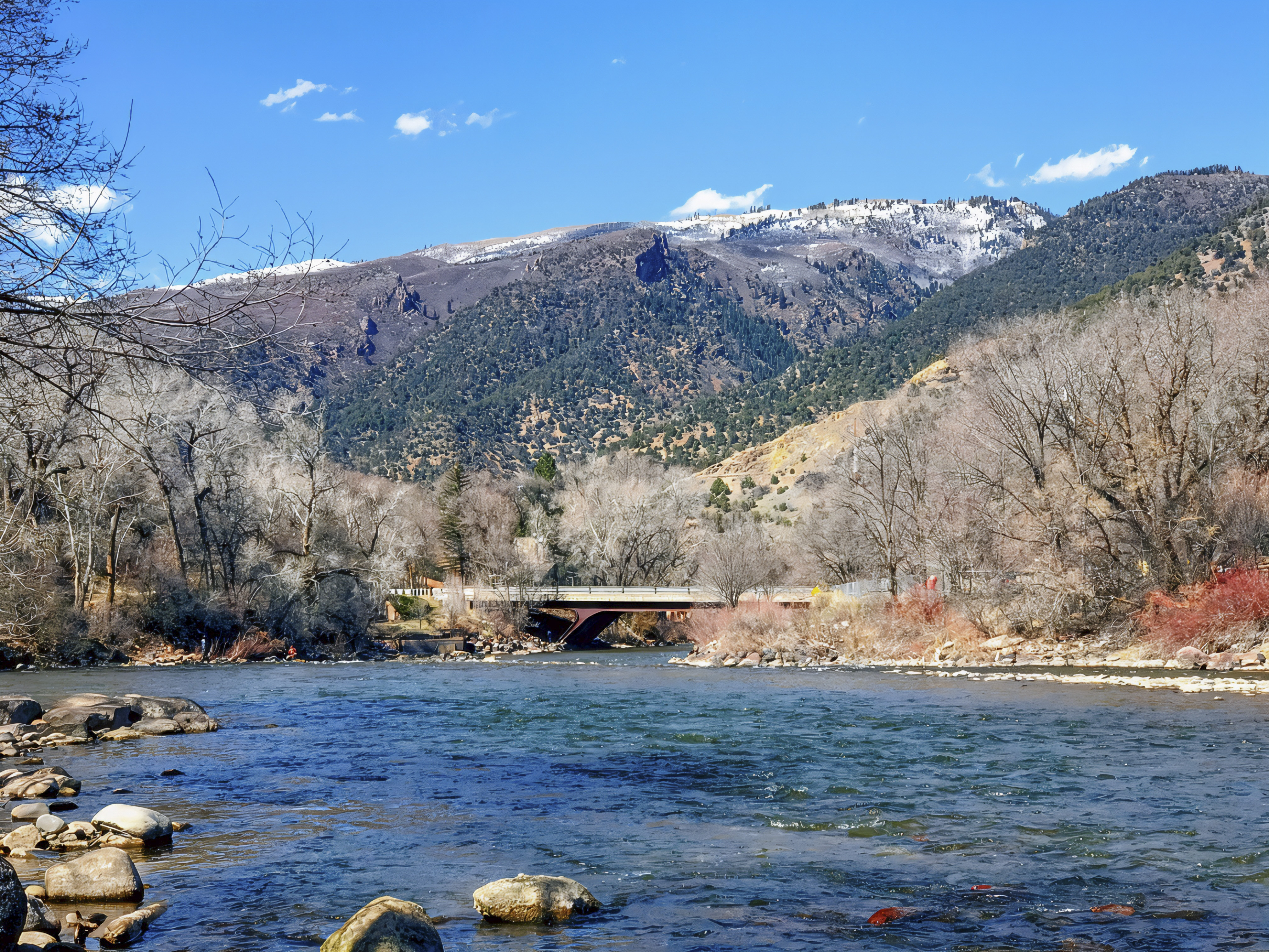
Traveling west from Glenwood Springs, Colorado, to Moab, Utah, offers an unforgettable road trip through the spectacular landscapes of the American West. The journey follows Interstate 70 through the Colorado River Valley before turning south onto US Highway 191 toward Moab. Leaving Glenwood Springs, travelers encounter the rugged highlands of western Colorado, where mountain ridges, sedimentary cliffs, and broad valleys create an ever-changing landscape. Continuing through the Rifle area, the scenery gradually transitions from mountainous terrain into the drier environments of the Colorado Plateau. The region reflects a fascinating geological history shaped by tectonic uplift, ancient sediment deposition, and millions of years of erosion. The Colorado River has played an important role in carving the Grand Valley and exposing rock formations that reveal the region’s distant past (National Park Service [NPS], n.d.-a). For travelers interested in natural history, the route provides an opportunity to witness how water, climate, and geological forces have transformed western Colorado over millions of years.


Continuing west along Interstate 70, the drive passes through the De Beque Canyon region, where the Colorado River winds between steep cliffs and layered sedimentary formations. The surrounding rocks include portions of the Wasatch and Green River formations, which preserve evidence of ancient rivers, floodplains, and lake environments from the Eocene Epoch (Johnson & May, 1978). Farther west, the highway approaches Palisade and Grand Junction, where the towering Book Cliffs and Mount Garfield dominate the northern side of the Grand Valley. These remarkable formations feature pale-gray slopes of Mancos Shale beneath more resistant sandstone cliffs, exposing sedimentary records associated with the ancient Western Interior Seaway. Erosion has gradually removed softer materials, leaving dramatic mesas, escarpments, and deeply dissected hillsides (NPS, n.d.-a). The area also demonstrates the ecological diversity of western Colorado, where semi-arid shrublands and pinyon-juniper woodlands coexist with vegetation supported by the Colorado River. Wildlife in the broader region includes desert bighorn sheep, coyotes, ravens, and other species adapted to dry environments (NPS, 2025).

Beyond Grand Junction, Interstate 70 continues west into eastern Utah, where expansive desert plains, distant mesas, and rugged mountain ranges define the surrounding Colorado Plateau. One particularly striking landmark is the snow-capped La Sal Mountains, visible across the desert landscape near the Colorado–Utah border and farther south toward Moab. Unlike the surrounding sedimentary plateaus, these mountains owe their formation to igneous activity, when magma intruded into older rock layers beneath Earth’s surface. Their higher elevations support forests and mountain ecosystems that contrast sharply with the dry shrublands below. Continuing along the route and turning south onto US Highway 191 near Crescent Junction, travelers encounter increasingly prominent red sandstone cliffs and isolated rock formations. Roadside stops along this corridor offer impressive views of the red rock country and distant La Sal Mountains. The region’s sparse vegetation includes drought-tolerant shrubs, grasses, and pinyon-juniper communities, while biological soil crusts composed of microorganisms, mosses, and lichens help stabilize desert soils and retain valuable moisture (NPS, n.d.-b). These fragile ecological communities demonstrate how life survives in some of the Southwest’s driest environments.

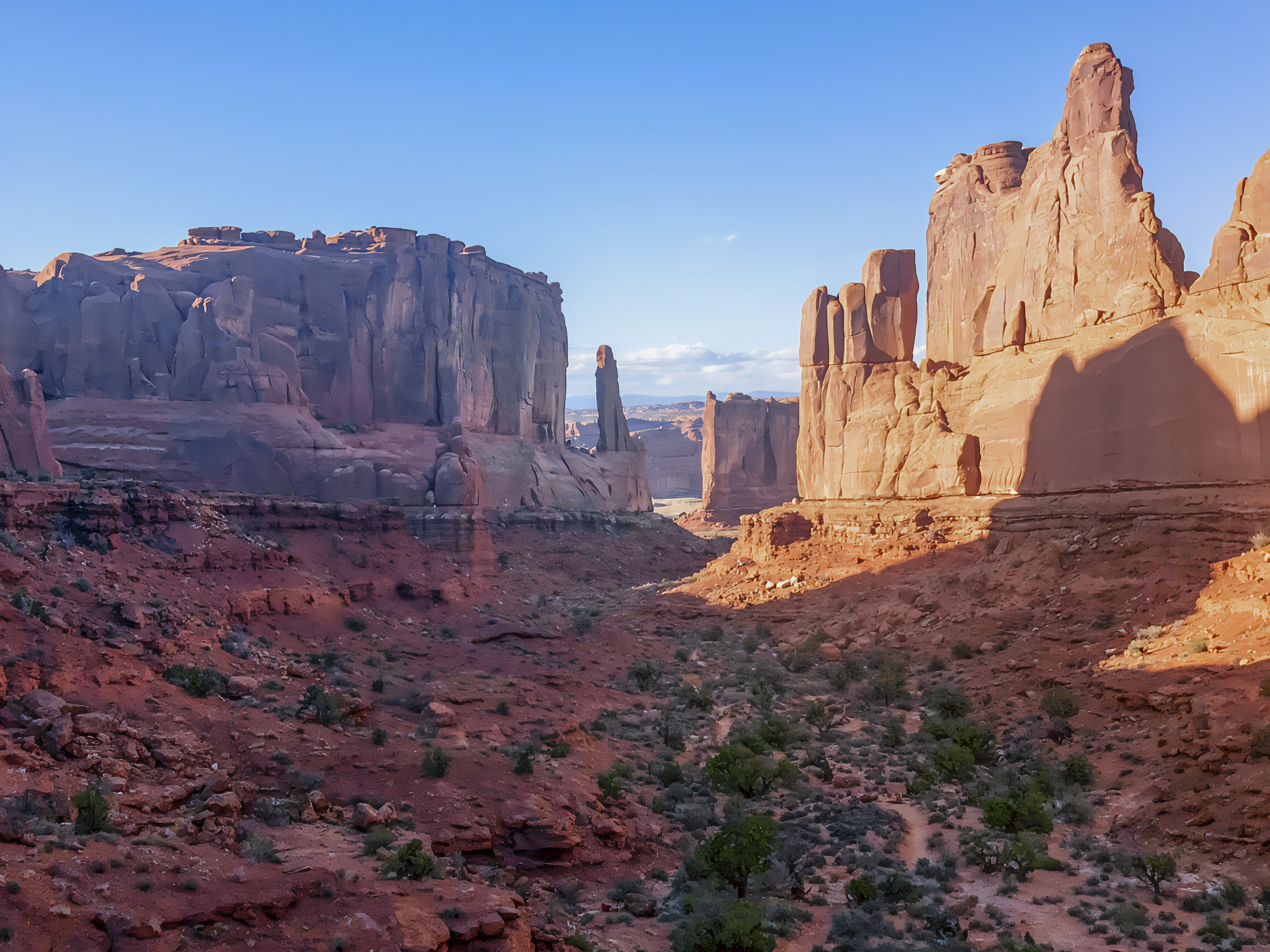
The final stretch along US Highway 191 toward Moab introduces travelers to some of southeastern Utah’s most recognizable sandstone landscapes. Towering cliffs, rounded rock formations, and broad desert valleys create an impressive entrance to a region famous for its national parks and outdoor recreation. Moab serves as a gateway to Arches National Park and Canyonlands National Park, offering opportunities for hiking, scenic driving, photography, and geological exploration (Discover Moab, n.d.). The surrounding rocks preserve evidence of ancient desert dunes, coastal environments, and extensive sedimentary deposits. In nearby Arches National Park, the famous sandstone arches developed through a combination of ancient salt movement, rock fracturing, weathering, and erosion (NPS, 2021). Beyond its recreational attractions, the Moab region offers an extraordinary outdoor classroom for understanding Earth’s geological evolution and desert ecology. From the Colorado River corridors and Book Cliffs of western Colorado to the vast red rock landscapes of Utah, this road trip reveals a remarkable transition between mountain environments, ancient sedimentary basins, and the delicate ecosystems of the Colorado Plateau.


References
Discover Moab. (n.d.). Moab maps and location information. https://www.discovermoab.com/maps-and-location-info
Johnson, R. C., & May, F. (1978). Preliminary stratigraphic studies of the upper part of the Mesa Verde Group, the Wasatch Formation, and the lower part of the Green River Formation, DeBeque area, Colorado, including environments of deposition and investigations of palynomorph assemblages. U.S. Geological Survey. https://doi.org/10.3133/mf1050
National Park Service. (n.d.-a). Geologic uplift: Why we rise above the valley. Colorado National Monument. https://www.nps.gov/colm/learn/nature/geologic-uplift.htm
National Park Service. (n.d.-b). Foundation document: Arches National Park. https://www.nps.gov/arch/learn/management/foundation-document.htm
National Park Service. (2021). Rock strata. Arches National Park. https://www.nps.gov/arch/learn/nature/rock-strata.htm
National Park Service. (2025). Nature and science. Colorado National Monument. https://www.nps.gov/colm/learn/nature/index.htm
AI Disclosure Statement:
Artificial intelligence tools were used in the creation of this page, including elements such as writing, image enhancement/generation, voice enhancement, and/or editing support. All final creative decisions were made by the creator.

Leave a Reply